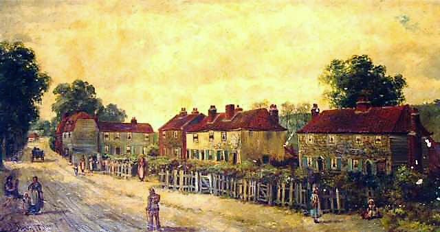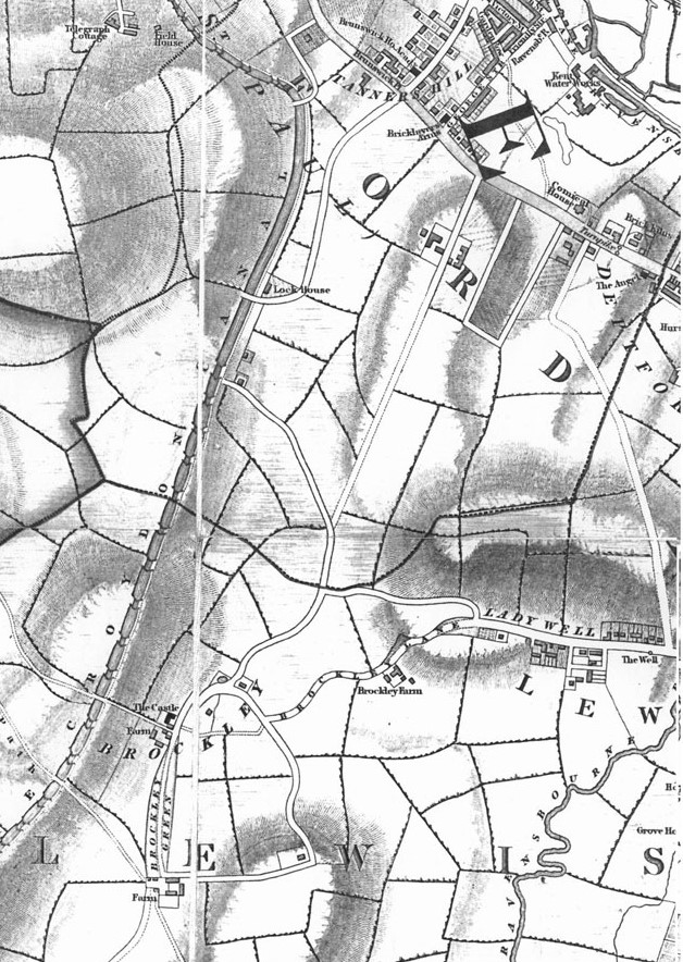
Ladywell developed as a wayside hamlet in the lane from Lewisham High Street to Brockley, a lane anciently called Vicarage Lane, later Brockley lane and now Ladywell Road, writes Julian Watson.
A small timber footbridge spanned the Ravensbourne but carts and horses forded the river. St Mary’s, the only church in the huge ancient parish of Lewisham, dominated the view from Ladywell.
The church, founded in the 10th century and rebuilt in the 15th and 18th centuries was the ecclesiastical and administrative centre of an area that encompassed Brockley, Forest Hill, Sydenham, Catford, Southend and Hither Green.
The present church building dates from 1777 with Victorian additions, but still has its medieval tower, built 1471-1512.
The 1692/3 Vicarage on the corner of Ladywell Road and Lewisham High Street is now Ladywell House.
The name Ladywell refers to the Well of Our Lady, an ancient spring of pure water beside the road. The site is now under Ladywell Bridge.
The name of the spring is taken from the nearby parish church of St Mary. A plaque marks the approximate site.
The spring was first recorded in 1472 when its flow was spectacular. Later, a mineral spring was discovered up the hill towards Brockley – there is a plaque on 148 Ladywell Road.
Major works to construct a main sewer in 1855 broke through a layer of clay and the ancient springs ran dry as did the picturesque stream that ran along Lewisham High Street and the mysterious well in the crypt of St Mary’s Church.
Ladywell was at first farmland with a holy well, then a rural hamlet with small cottages built on the waste beside the lane.

It was surrounded by the fields of Slagrave and Bridgehouse Farms and also glebe land belonging to the Vicar of Lewisham (as in Vicar’s Hill).
The coming of the railway to Lewisham in 1849 and the opening of Ladywell Station in 1857 brought rapid development changing Ladywell into a London suburb with local shops and two pubs.
The first and principal developer was Samuel Jerrard of Porson Street (a long demolished road which ran beside the railway viaduct from Elmira Street to Loampit Vale).
A builder, employing 240 men and 10 boys, he began the development of Algernon and Embleton Roads and Vicar’s Hill. In the 1890s the wayside cottages in Ladywell Road were demolished and the land redeveloped with shops and houses.
In 1900 a large workhouse for the elderly poor of Bermondsey was built on Slagrave Farm. It was later known as Ladywell Lodge. Most of the workhouse was later demolished but some of the buildings have survived in and beyond Slagrove Place.
The large 17th century mansion, Lewisham House which stood on the corner of Ladywell Road next to the church was demolished in 1894 and replaced immediately with municipal buildings: a fire station, police station, coroner’s court and swimming baths (Playtower). The Parish Hall, now St Mary’s Centre, next to the Playtower was built in 1891 on glebe land.
This is the first in a series of articles on the history of our neighbourhood.

1 comment
At the end of the WW2, my mother would take me to a market in ladywell, it was tucked away north side of high street. We wentespecially to buy horse meat or whale meat which was off ration. We would then go to the baths attached to the swimming pool as we didn’t have enough hot water to fill a tin bath at home. From there to have lunch at the British Restaurant which was at the back of the swimming bath buildings. This was simple and without coupons ie not rationed. Then walked home to our flat over Lloyd’s Bank opposite the clock tower..